Flooding chaos as torrential rain dumps 52mm in just 60 minutes
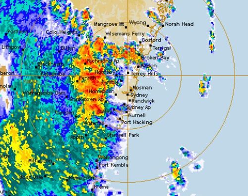
Torrential rain brought 52mm of rainfall in just 90 minutes across Sydney’s CBD today as the east coast was battered by a fierce and stormy rain bomb.
Thunderstorms rolled across the state, bringing with them giant hail, destructive winds and heavy rainfall after the Bureau of Meteorology warned an “unsettled” day of wild weather was ahead.

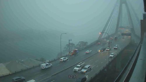
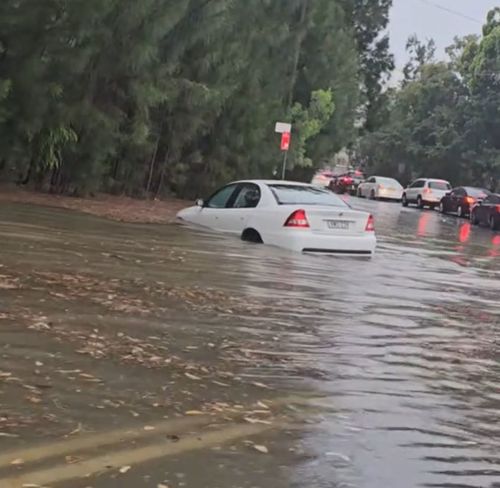
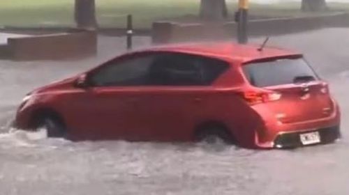
Sydney was smashed with thunderstorms and heavy rain led to flash flooding across the CBD, Inner West and eastern suburbs.
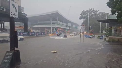
Roads in Strathfield in the city’s Inner West became rivers and caused traffic chaos, along with parts of Parramatta and the eastern suburbs.
Horsley Park in western Sydney was drenched with 77.6mm of rain in just one hour, while streets in Riverstone in the city’s west was flooded with knee-high water.
Wind gusts at Sydney Airport clocked over 70km/h at the peak of the storm.
Massive hailstones, cars submerged as NSW is smashed by storms
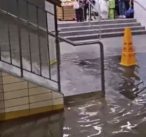
Town Hall Station in Sydney’s CBD also turned into a waterfall and caused chaos for lunchtime commuters earlier today.
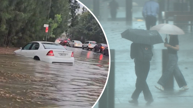
The brief but intense thunderstorm resulted in a handful of drivers needing to be rescued as roads quickly became rivers.
There were more than 22 flood rescues in the Sydney area as the flash flooding caught drivers by surprise.
The NSW SES has responded to 559 incidents so far today after the storms damaged homes and flooded roads across the state.
“If you come across a flooded road, turn around and find an alternative route,” a spokesperson for NSW SES said today.
“Never drive, walk or play in flood waters. Flash flooding can occur suddenly and without warning.”
Several major roads remain closed, including Wallgrove Road at Cecil Hills between Elizabeth Drive and Villiers Road.
Trains were running at a reduced frequency on the Olympic Park line in Sydney while some buses diverted routes to avoid flooded roads.
NSW SES State Duty Commander, Assistant Commissioner Nicole Hogan, said crews are still working to respond to storm and flood-related incidents and urged residents across the state to stay safe and keep across alerts.
“Flash flooding can occur suddenly and without warning. If you come across a flooded road, turn around – there is always another way,” Hogan said.
“With further severe weather likely over the coming days, take steps now to prepare. Park vehicles under cover, tie down loose items and check gutters and drains at your home for blockages.”
The wild weather has smashed Wollongong along with central NSW regions Goulburn, Wagga Wagga, Mudgee and Orange.
The bureau then updated its warning earlier today to include the South Coast, including Batemans Bay, Eden, Bega, Moruya and Merimbula.

The most severe storms have so far focused on the city’s south-west and stretched as far as the Blue Mountains.
Senior meteorologist Miriam Bradbury said tomorrow’s forecast is set to be a little calmer but storms are still likely across the east coast, including some Queensland border towns.
“Heavy rainfall, damaging winds and large hail will all continue a risk throughout the east tomorrow,” she said.
A severe thunderstorm remains in place for parts of central western NSW.
Storms likely to produce heavy rainfall which may lead to flash flooding, large hailstones and damaging winds are forecast for Scone, Tamworth, Gunnedah, Narrabri, Walgett, Coonabarabran, Coonamble, Bourke and Brewarrina.
The Bureau of Meteorology also issued a severe weather warning for intense rainfall today and tomorrow across the NSW South Coast, impacting Batemans Bay, Eden, Bega, Moruya Heads, Narooma and Merimbula.
The region is forecast to be smashed with dangerous and intense rain leading to flash flooding, with six-hour total set to top 150mm.
A similar warning is in place for Taree on the mid-north coast along with the Riverina, North West Slopes and Central West Slopes areas.
The bureau warns there is a chance of large hail, heavy rainfall and damaging winds across these regions.
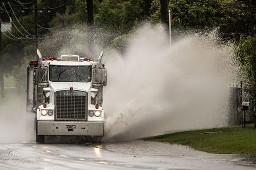
The town of Harden, around 125km from Canberra, was already battered with extra large hailstones during a flash storm.
The small town’s roads turned into sleet after a hailstorm around 9am today.
Trucks were brought in to clear the road from ice.
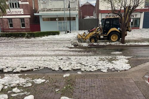
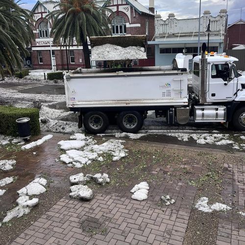
Many buildings in Harden sustained major storm damage, including collapsed roofing and smashed windows.
“Harden coped one huge storm this morning most shops are severely water damaged our post office has smashed windows and leaks everywhere,” councillor Michelle Gallo said on Facebook.
There is now quite the clean-up left for residents after hail and rain battered the area.
Harden’s SES unit has received 136 incidents since 6am today.
>read more at © 9News
Views: 0